In brief:
- Geomatics is the discipline that brings together the methods and technologies used to collect, process, analyse and distribute geographic data.
- It differs from a geographic information system, which is only one of its tools.
- It covers several careers, from geomatician to surveyor, with different duties and levels of responsibility.
- Training ranges from a higher technician qualification to an engineering degree or master’s, with a growing place given to data and programming.
Geomatics covers the methods, technologies and careers used to collect, process, analyse and distribute information located in space. The term, a contraction of geography and computer science, is increasingly used within local authorities, as geographic data becomes a routine basis for decisions, from processing a planning permit to planning a technical network.
What geomatics is
Geomatics covers a full chain, from acquiring raw data in the field to distributing it in a form that a department or the public can use. It is not limited to a single piece of software or method: it combines contributions from geography, surveying, computer science, spatial statistics and, increasingly, large scale data analysis.
The discipline differs from a geographic information system, which is only one of its tools. A GIS brings together the hardware, software and databases used to store and query geographic information, while geomatics covers a wider scope: it includes field data acquisition, its theoretical foundations in terms of projection and accuracy, and the careers that put it to work day to day.
The activities of geomatics
Three main activities structure the discipline, following a broadly constant order whatever the project.
Data acquisition
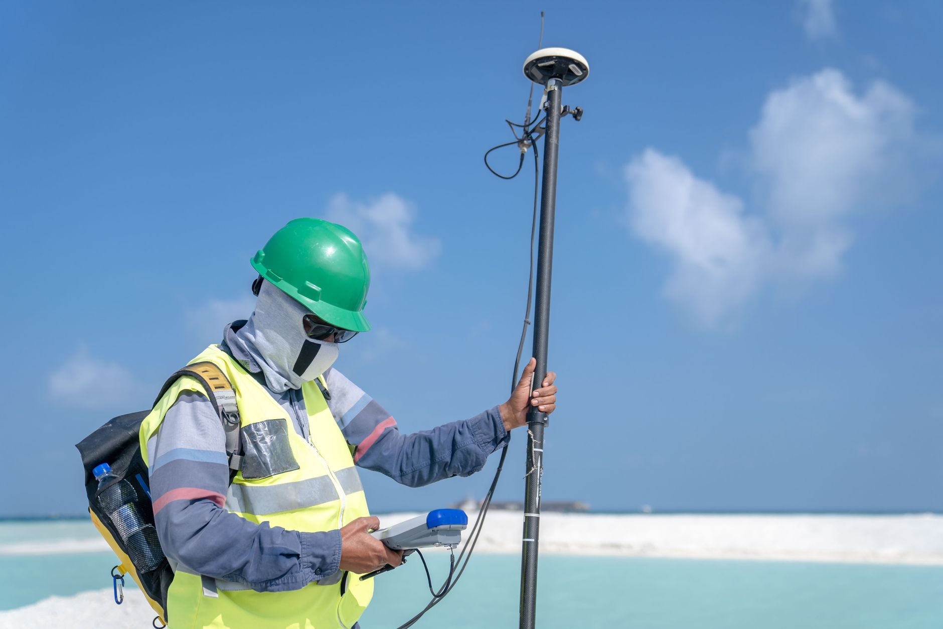
Acquisition brings together field measurements taken with surveying instruments, positions obtained from a satellite receiver, and imagery produced by remote sensing, whether from a satellite, an aircraft or a drone. Each method answers a different scale and accuracy: a ground survey remains necessary for centimetre level accuracy, while aerial imagery quickly covers a wide area at a lower accuracy.
Processing and analysis
Raw data is then turned into usable objects: addressing reference datasets, digital terrain models, zoning layers or structured databases. This stage draws on image processing skills, spatial statistics and, increasingly, programming to automate repetitive processing on large volumes of data.
Distribution
The final stage makes geographic data useful to its intended audience: a map a councillor can read, a dataset opened to the public as part of open data, or a feed another information system can query. A geographic dataset that is perfectly acquired and processed serves no purpose if its distribution stays limited to whoever produced it.
Applications within local authorities
Geomatics feeds very concrete uses within a local authority. Planning and urban development form its historical ground: processing permits, tracking regulatory zoning, drawing up planning documents. Managing technical networks, roads, drainage, public lighting, also relies on accurate geographic reference data to plan interventions and track assets.
Other uses have been added more recently: environmental monitoring, natural risk prevention, or land use analysis to prepare a land strategy. In each case, the value of geomatics does not come from any particular tool, but from the quality and regular updating of the data used.
The careers of geomatics
The term geomatics covers several complementary profiles, whose duties vary with the size and organisation of the structure. The geomatician designs, manages and develops geographic databases and associated tools; they act as the interface between a department’s operational needs and the technical constraints of the data. The surveyor carries out field measurements and guarantees their accuracy, a condition for the reliability of any later processing.
The cartographer turns this data into graphic representations that non specialists can read, while more cross cutting roles, GIS project lead or spatial data administrator, coordinate the whole on behalf of a department or technical service. In a small authority, these duties can sit with a single person; in a larger structure, they are split across several specialised positions.
Training that leads to careers in geomatics
Access to careers in geomatics runs through pathways of different levels, which complement rather than compete with one another. A higher technician pathway, completed in two or three years in a surveying or geomatics specialism, prepares for field survey roles and the routine use of GIS tools. A professional degree builds on this base with a sector specialism, for example land planning or the environment.
At master’s or engineering degree level, completed in five years, training adds more advanced skills in modelling, geodesy and large scale data processing, opening the way to project design and management roles. A shared trend runs through all these pathways: a growing share given to programming and automated data processing, which complements rather than replaces a solid grounding in geography and surveying.
Frequently asked questions
What is geomatics, in practical terms?
Geomatics covers the methods and technologies used to collect, process, analyse and distribute information located in space. It combines contributions from geography, surveying, computer science and spatial statistics to produce usable knowledge about a territory.
What is the difference between geomatics and a geographic information system?
Geomatics is the discipline as a whole, and a geographic information system is one of its tools. A GIS brings together the hardware, software and data used to store and analyse geographic information, while geomatics also covers field data acquisition, its theoretical foundations and the careers that put it to work.
What careers does geomatics cover?
The term covers several complementary profiles: the geomatician who designs and manages geographic databases, the surveyor who carries out field measurements, the cartographer who produces graphic representations, and more cross cutting roles such as project lead or spatial data administrator within a technical department.
What training leads to a career in geomatics?
Pathways range from a higher technician qualification, completed in two or three years in a surveying or geomatics specialism, to an engineering degree or a master’s degree, completed in five years with a specialism in geographic sciences, geodesy or spatial analysis. Most of these pathways now include a growing share of programming and data processing.
Does a geomatician's salary depend on their employer?
Yes, pay varies depending on whether the position is held in a local authority, a private consultancy or a larger group, as well as on the level of responsibility and seniority. No single figure can reliably summarise this range of situations.